Driving across the Nullarbor – Part One: West Australia
A 2,700km stretch of road named “not a tree in sight” and nicknamed ‘Nullar-boring’ by locals doesn’t sound that exciting, does it? Well, in fact, the Nullarbor boasts a mysterious ‘nymph’, the world’s longest golf course, a magnificent whale-watching platform, and is littered with caves and blowholes. Driving across the Nullarbor, from West Australia to South Australia, it turns out, actually was quite an adventure. Having set off from Esperance, this post details day one of the two-day journey across the Nullarbor.
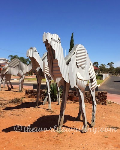
Norseman – Gateway to the Nullarbor
Norseman is where those arriving from (even) further West join the Nullarbor, a small gold mining community about 200km north of Esperance. At one stage, Norseman was the second richest goldfield in Australia, only beaten by nearby Kalgoorlie. The Norseman Gold Mine has been in operation for the longest continuous production of gold in the whole of Australia, over 65 years. Norseman honours its fame as WA’s gateway to the Nullarbor with camels (the ships of the desert) made from corrugated iron encircling the main roundabout in town. The town offers vital last minute supplies to travellers heading east, and possibly the largest petrol station I have ever seen, with a separate section for refuelling roadtrains (one of three petrol stations in the town). The roadhouse is just behind the mega petrol station.
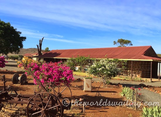
Fraser Range Sheep Station
Halfway between Norseman and Balladonia, Fraser Range is an extremely remote, working sheep station. It’s not what you expect to find on the Nullarbor. The station is surrounded by the world’s largest hardwood forest and has a dense tree canopy stretching as far as the eye can see in every direction. It is a vastly different landscape from the rest of the Nullarbor Plain. (It’s one extreme to another around here!) The first hole of the ‘Nullarbor Links’ golf course (or last if you’re travelling west) is at the station, which offers accommodation (rooms or camping) and an evening meal. If you fancy a short walk on arrival, on climbing the escarpment nearest the station you’ll probably see emus and wallabies enjoying a lazy afternoon.
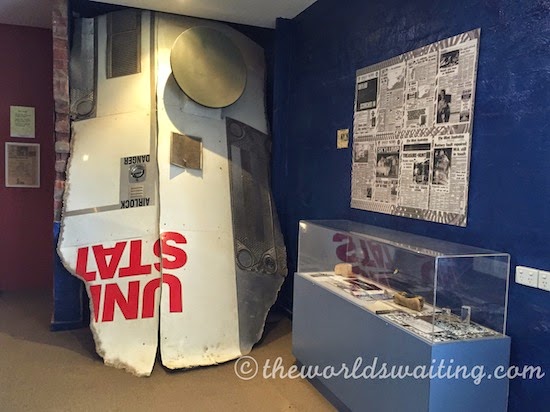
Skylab hits Balladonia, Western Australia
Balladonia’s claim to fame is that NASA’s Skylab crashed to earth at Balladonia in 1979. Amusingly, the Shire of Dundas issued a littering fine over the incident and apparently the then US President Jimmy Carter telephoned the Balladonia Roadhouse to apologise. Chunks of Skylab can be seen at the small but informative museum next to the Balladonia Roadhouse as well as other interesting insights into life at Balladonia through the years, including several historic photos. We thought reading the newspaper coverage of events really made the Skylab excitement come alive. If Skylab is of special interest to you, there is another display about it in the Esperance Museum.
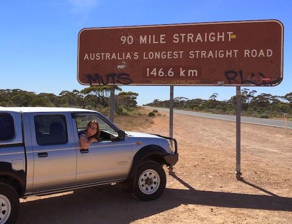
90 Mile Straight on the Nullarbor
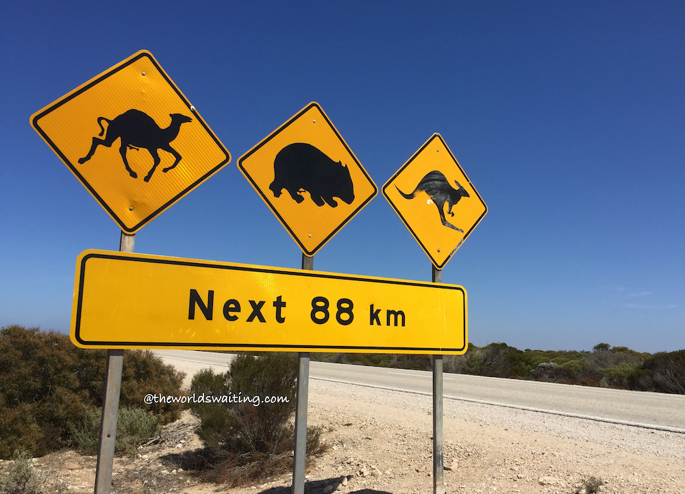
After leaving Balladonia you hit the 90 Mile Straight, which literally is a stretch of road, 90 miles long, that is completely straight. It’s very uncomplicated to drive, so long as you don’t doze off or hit any errant wildlife. There was a lot of roadkill (kangaroos) on this stretch, so it clearly happens. I also spotted a large lizard step boldly out in front of a massive roadtrain and feared the worst, only for him to turn tail at the very last minute. Phew!
Caiguna blowhole
As you bowl along the road a sign is just about visible on the approach to Caiguna indicating ‘blowhole’ to the right. Intrigued? Pull off the road into the large open space and have a look. In the corner, worryingly close to the road in fact, was a dip in the ground surface, about a metre in diameter that, on closer inspection, was a hole. You can hear air movement inside as you approach and ice-cold air blows out around your knees, underground air-conditioning! The Nullarbor is atop a large chunk of limestone, and as a result, has an extensive network of caves (called the Murrawijinie caves), through which the Southern Ocean blows, hence the cool air. (The cave at Cocklebiddy has been closed due to instability, but there is another about 10km north of the Nullarbor Roadhouse).
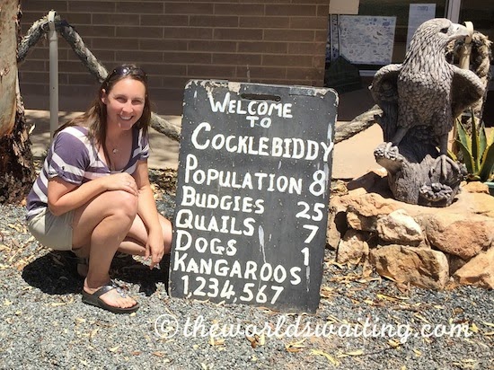
Eyre Bird Observatory and Cocklebiddy
The Cocklebiddy Roadhouse has adopted the Wedgetail Eagle as its icon, following the rescue of one that was hit by a vehicle on the highway here (miraculously, and following being flown to Karratha for treatment, it survived!) Apparently there are no longer rabbits here, following the outbreak of a bunny disease, so the eagles now approach the highway looking for roadkill to eat, a dangerous activity when you struggle to get airbourne quickly. It is hard to imagine they go hungry though, as there was an alarming number of dead kangaroos along this stretch. There is accommodation, a shop and a restaurant at the roadhouse, as well as an amusing sign informing visitors about the dynamics of the local population, and rather randomly a large budgerigar enclosure.
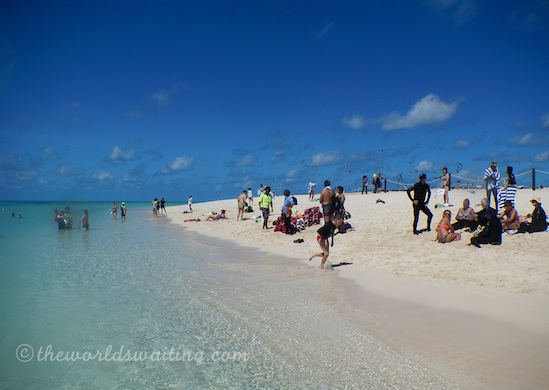
Cocklebiddy is also the point from which the Eyre Bird Observatory can be accessed. Situated in the old Eyre Telegraph Station, the building was transformed into Australia’s first bird observatory in 1977. The observatory is a centre of bird studies and conservation activities that visitors are welcome to join. Various courses are offered, as well as birdwatching, bushwalking, beach-combing and stargazing. Basic accommodation and meals are available.
Eucla and the buried Telegraph Station
Shortly after passing Mundrabilla, and on the last stretch to Eucla, around a bend in the road I came face to face with a very large kangaroo standing proud in the centre of the highway. I slowed right down quickly, and the kangaroo bounded off in the other direction, a timely reminder to keep my wits about me. I counted over 130 kangaroos before reaching Eucla. This one was the only one I saw alive.
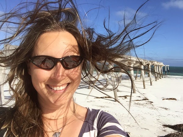
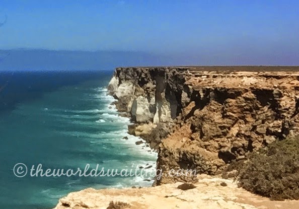
As the last town on the West Australian side of the state border, Eucla today sits in isolated splendour atop the Bunda Cliffs. Just below the small settlement is an unsurfaced road leading across a vast sandy plain to the beach, jetty and telegraph station. The original township was originally on this plain, but has been covered by shifting sand dunes. The Telegraph Station was established in 1877 and was a vital communication link connecting WA to the rest of the world until 1927. Incredibly, in the 1890s Eucla was Australia’s busiest telegraph station outside the capital cities. Nowadays the building is almost entirely buried in sand, with only a few walls still visible. Eucla’s historic jetty ruins can also be seen at (windy!) Eucla Beach, which is a 1 km walk along a sand track (or accessible in a 4WD vehicle). Be sure to take note of the large gum tree by the Telegraph Station to navigate your way back to the path! Eucla Roadhouse is the largest establishment on the Nullarbor. It offers basic rooms, hotel rooms and camping options, a bar and restaurant.
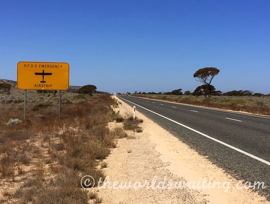
While Eucla is extremely remote from the rest of the world (just over 1,200km from Adelaide and even further from Perth), driving on the Nullarbor doesn’t actually feel that remote. There is frequently company on the road, ranging from the intimidating and enormous roadtrains, and happy campers to some battered-looking (and clearly crazy) cyclists. While anticipating this trip I had imagined the possibility of breaking down somewhere and having to wait hours before anyone passed and even noticed, never mind sorting out the situation. Somewhat incredibly there are roadhouses scattered along the length of the Nullarbor, roughly every 200km, so there is actually quite an effective support network. The road itself also doubles as a runway for the Royal Australian Flying Doctors Service, should someone need it. Thinking about it, planes landing and taking off from the road must be an incredible sight, but I’m also glad I didn’t witness it.
To read the about the rest of the journey across the Nullarbor click here!
You May Also Like
Land of culture, land of curiosities – Embracing Thailand
Expat Banking